Overview
Location
Eastern Athabasca Basin, Saskatchewan, Canada
Ownership
100% IsoEnergy
Deposit Type
Unconformity related sandstone and basement hosted uranium
Stage
Exploration
Primary Minerals
Uranium
Technical Maps
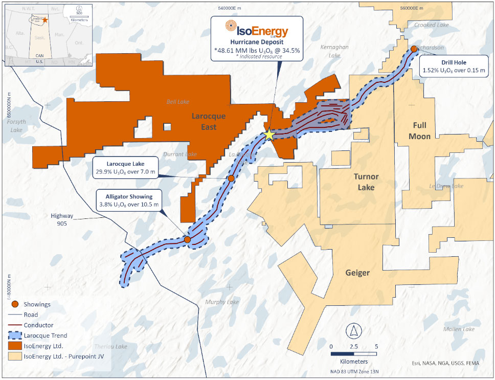
Location map of the Larocque Trend spanning across IsoEnergy’s projects.
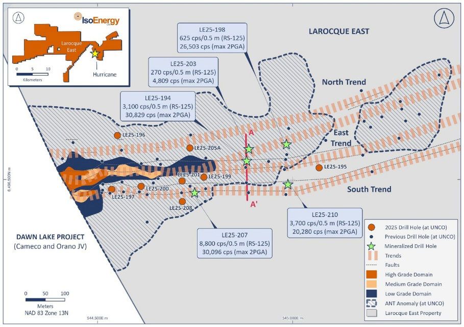
Location of winter 2025 drill holes with respect to the Deposit resource footprint (blue) and the ANT seismic low velocity zone in which the Deposit occurs, and projected Hurricane mineralization-controlling fault zones. RS-125 values are highest averages over 0.5 m intervals.
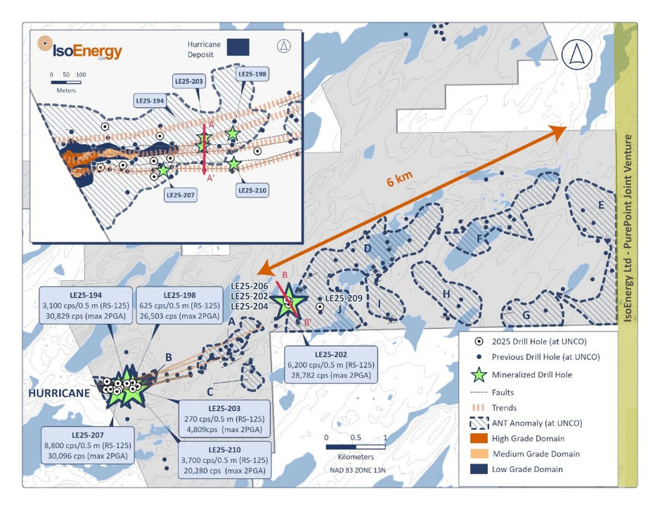
Location of 2025 target areas and winter drill holes along the Larocque Trend, including drill holes in Target Area D, located 2.8 km east of the Deposit. In addition to targets near the Deposit, greenfield potential will be tested this summer in areas D, E and F along a six-kilometre segment of the Larocque Trend. RS-125 values are highest averages over 0.5 m intervals.
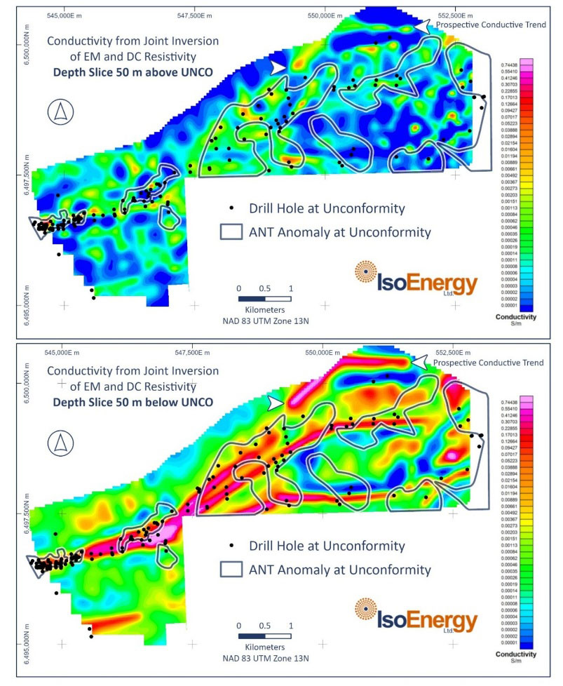
Joint resistivity – electromagnetic inversion model of the Larocque East project completed by Convolutions Geoscience and Computational Geosciences that highlights an untested 2,500m northern conductivity trend.
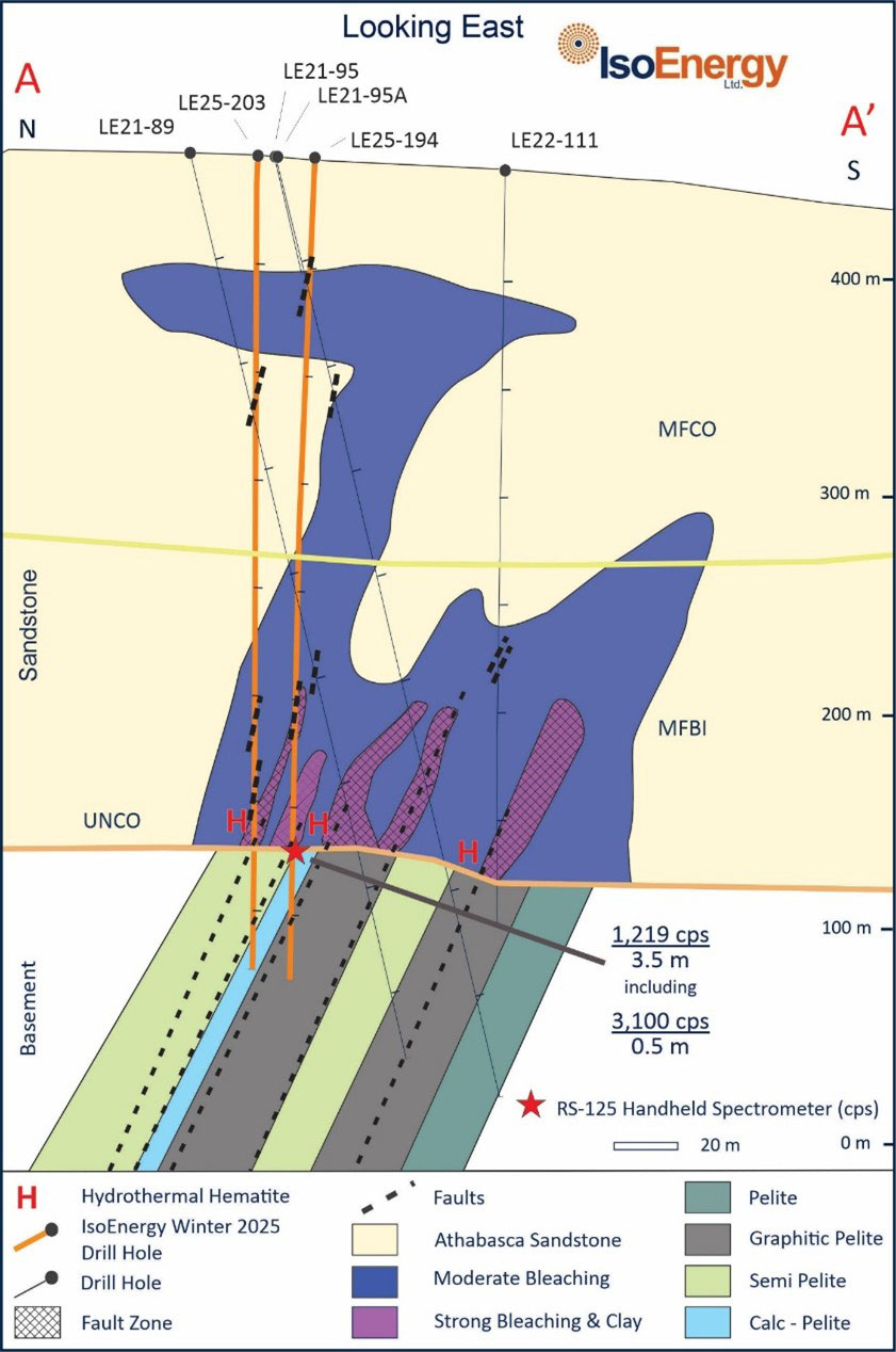
Main Trend: Cross section through LE25-194 and LE25-203 on the East Trend looking east.
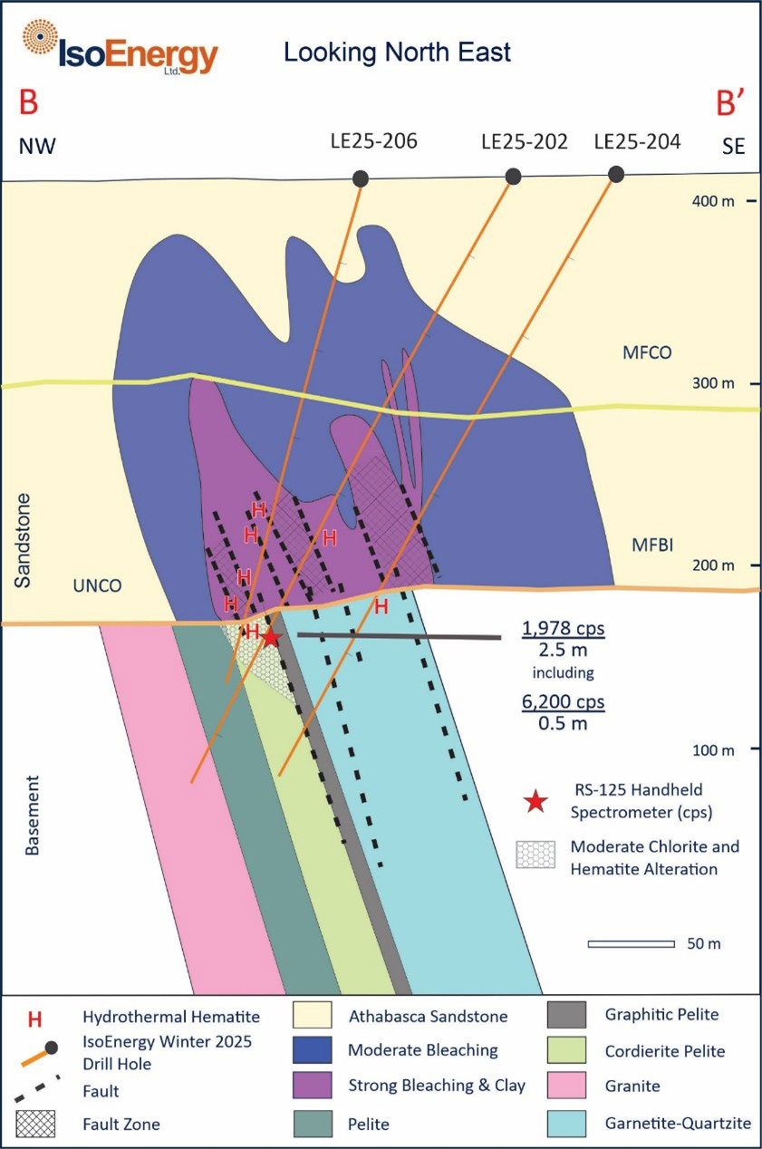
Cross section through LE25-202, 204 and 206 on the west end of Target Area ‘D’ looking east.
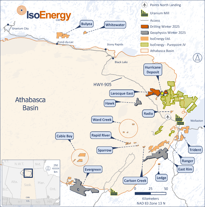
Location of IsoEnergy’s exploration projects in the eastern Athabasca Basin.